ER-COIN
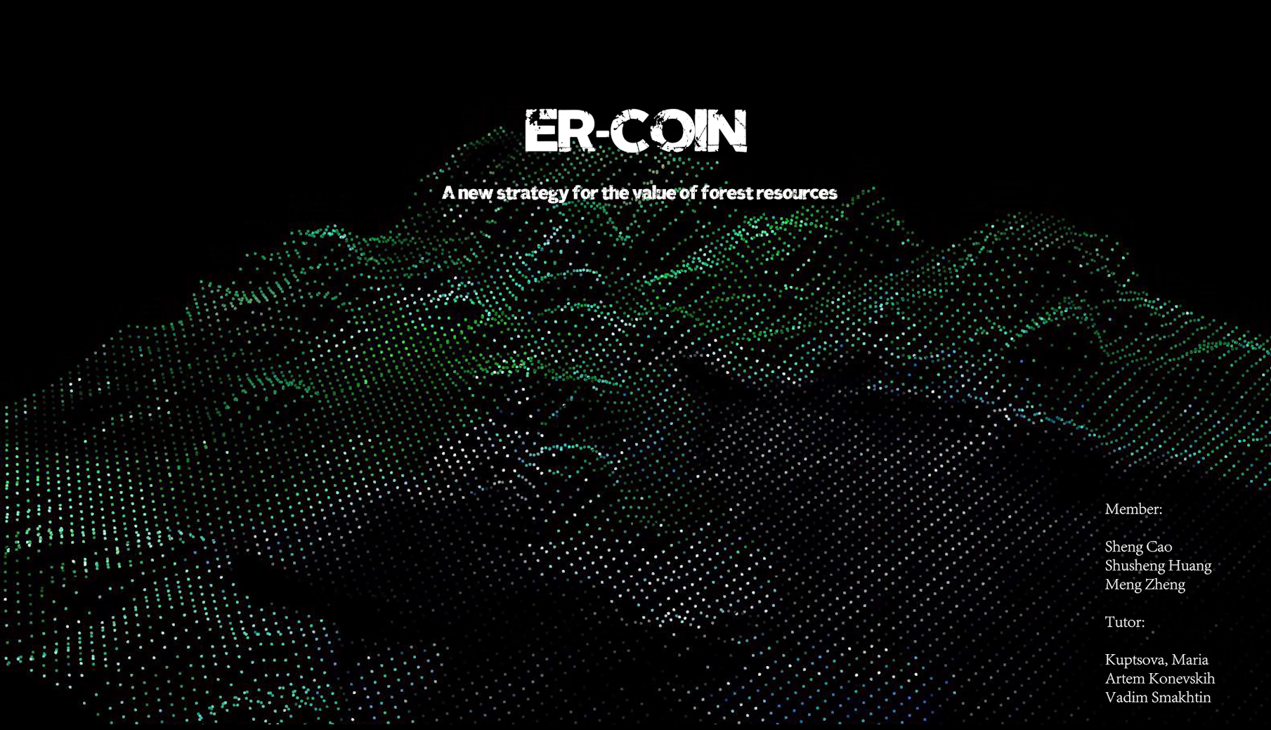
A new strategy for the value of forest resources
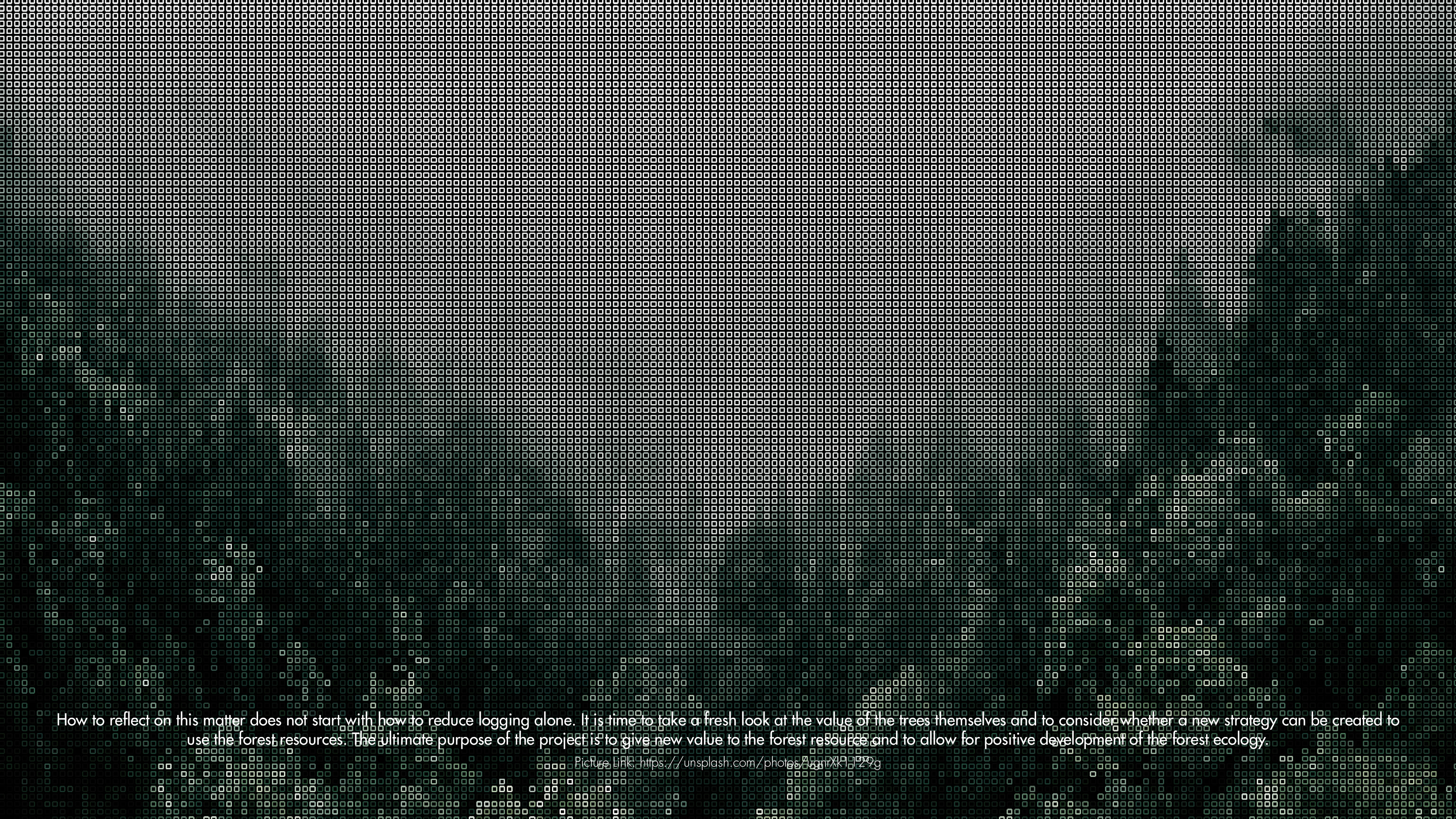
The forest, an ancient and dynamic ecosystem. It has existed on Earth for billions of years, witnessing the rise and fall of countless species without ever becoming extinct. Forests are great, and they have given the world not only a lush green color but also an immense natural resource. In the past, forests gave mankind space, land, energy, and food to survive. But in the future, the forest can be able to discover more of its value. This is a matter for everyone. The southern part of Russia, adjacent to China, Vladivostok. This region is geographically unique in that it is surrounded by the sea on three sides, contains a large forested area to the north. However, even though the abundance of forest reserves at this stage, but according to correlation analysis of the region's forests, in the future, forest areas are in continuous decline. So, can we redefine the value of forest resources? So will there be potential about exploring a series of forested areas of Vladivostok, scanning the area to reconstruct the information model, and following up with visual visualization or data analysis to measure this new strategy?
Forest resources have often been used as timber resources in the past, use that not only destroys the biological chain but also goes against the principles of sustainable development. So in the future, we can protect forest systems and use the renewable resources of forests in a way that redefines forest values and uses the sustainable products of forests, such as oxygen, groundwater, and other products. This leads to another concept, the preliminary block-chain industry.
The new concept of forest production value is the product of combining virtual and real, so, how can this new strategy be visualized? There are three strategies for resolving the visualization.
- Strategy I: a four-part approach is proposed here to define new landscapes - Future change and development of forest area patterns.
- step 1, understanding the basic patterns of the forest;
- Step 2, understand specific range of forest patterns and make comparisons;
- step 3, blend existing patterns with stylegan;
- step 4, conversion between features;
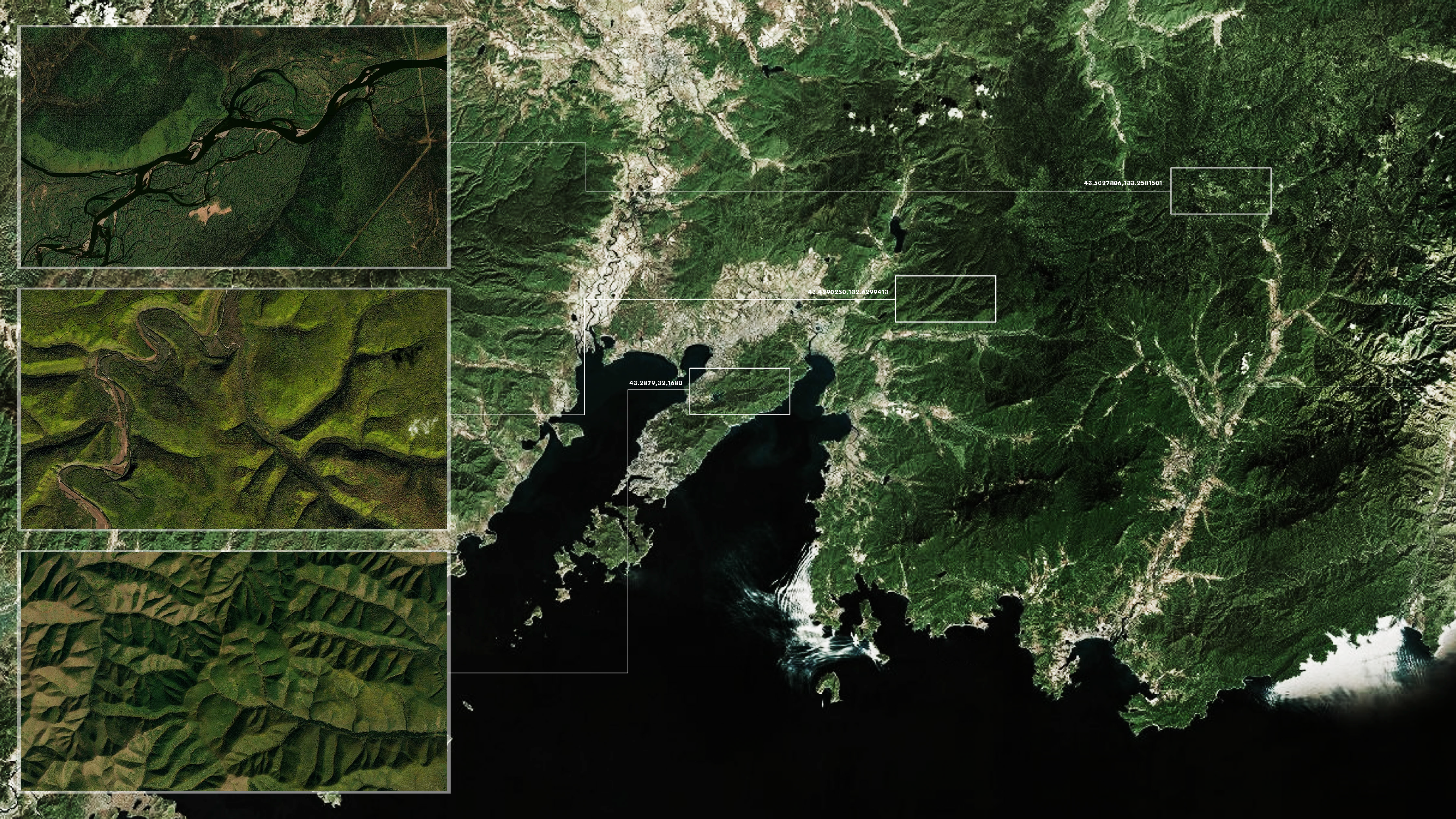
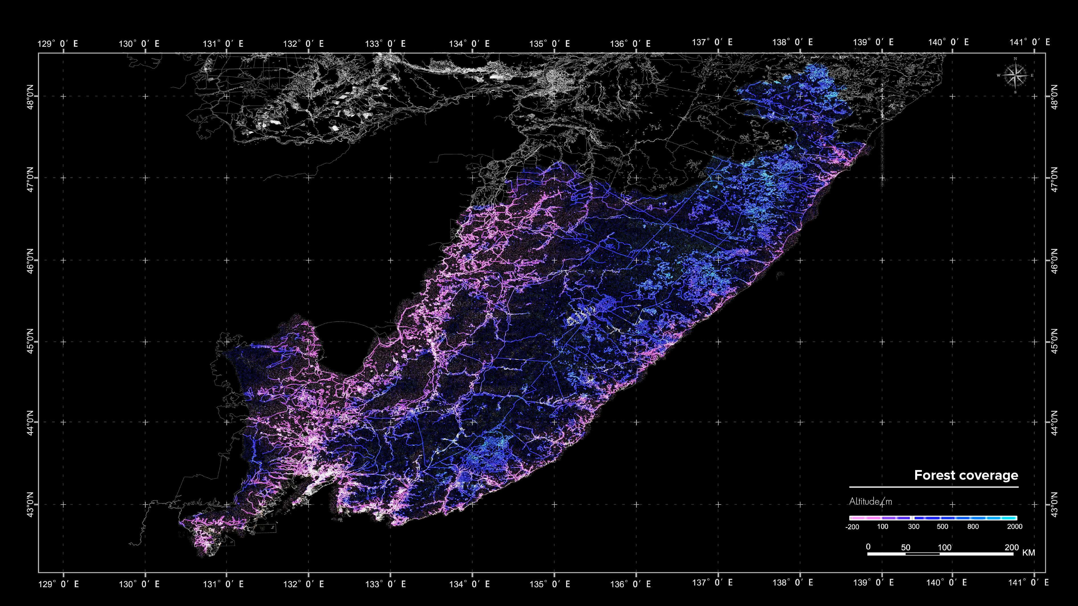
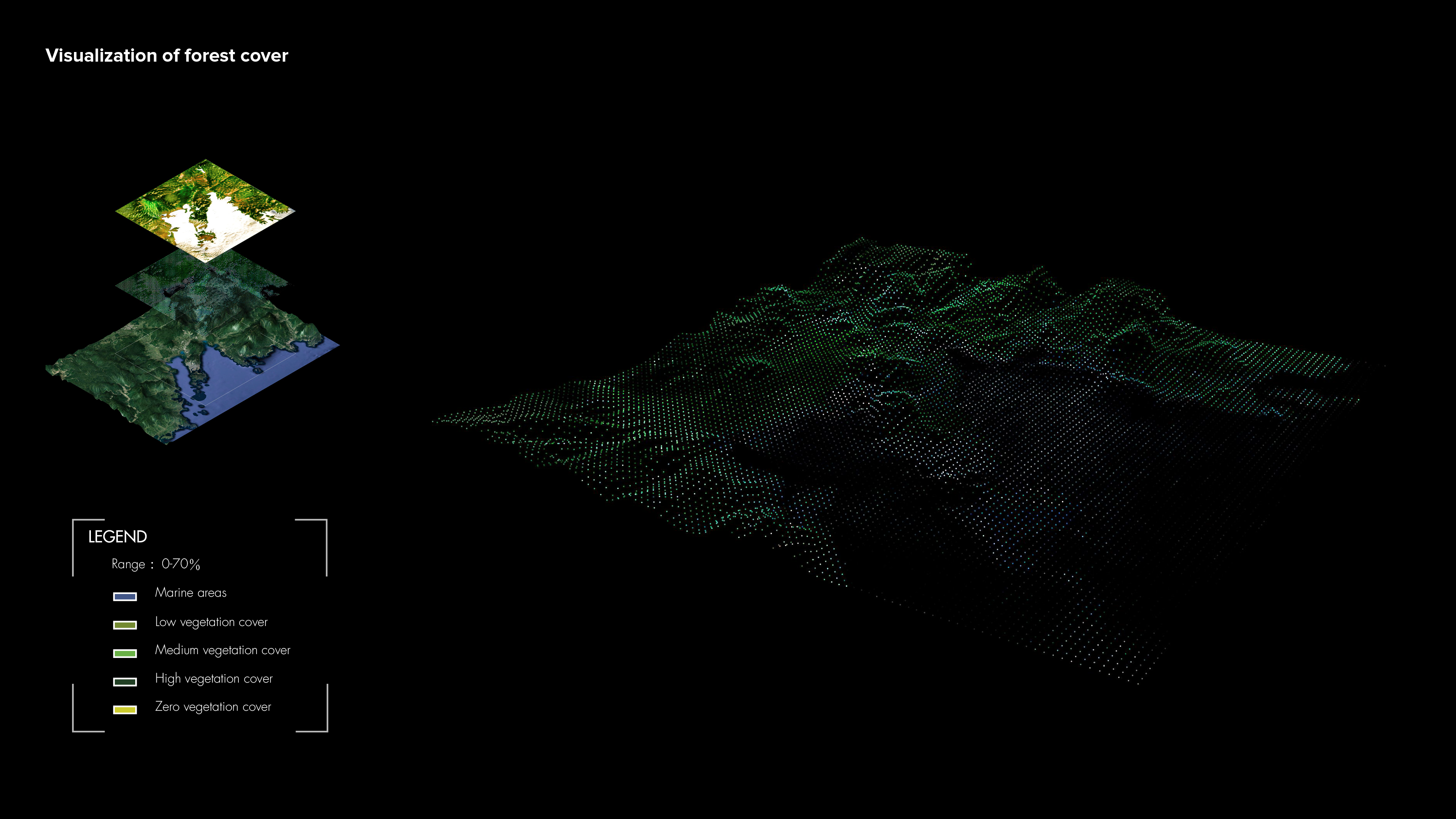
- Strategy II : Changes and developments in forest area satellite data - defining the new data.
- Step 1, Vladivostok-wide satellite data map;
- Step 2, understanding the forest area base data; Hybrid data import stylegan;
- Step 3, stylegan fusion of existing data; stylegan results presentation ;
- Strategy III: define a new economy based on new landscapes and new data.
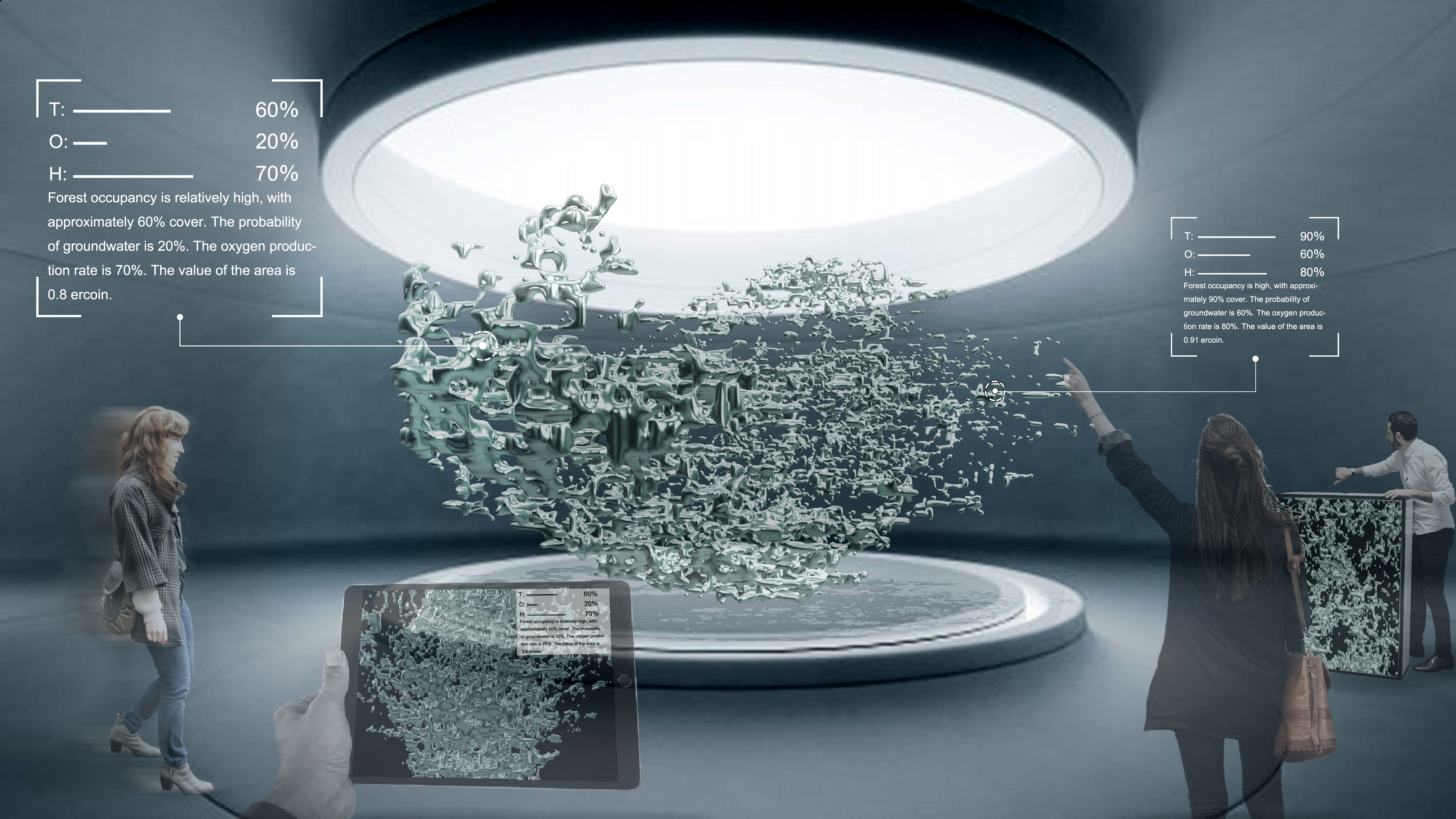
- Step 1, refining the description of the blockchain industry - eliciting 3d virtual models as currencies.
- Step 2, source of data for currency --- oxygen discharge analysis.
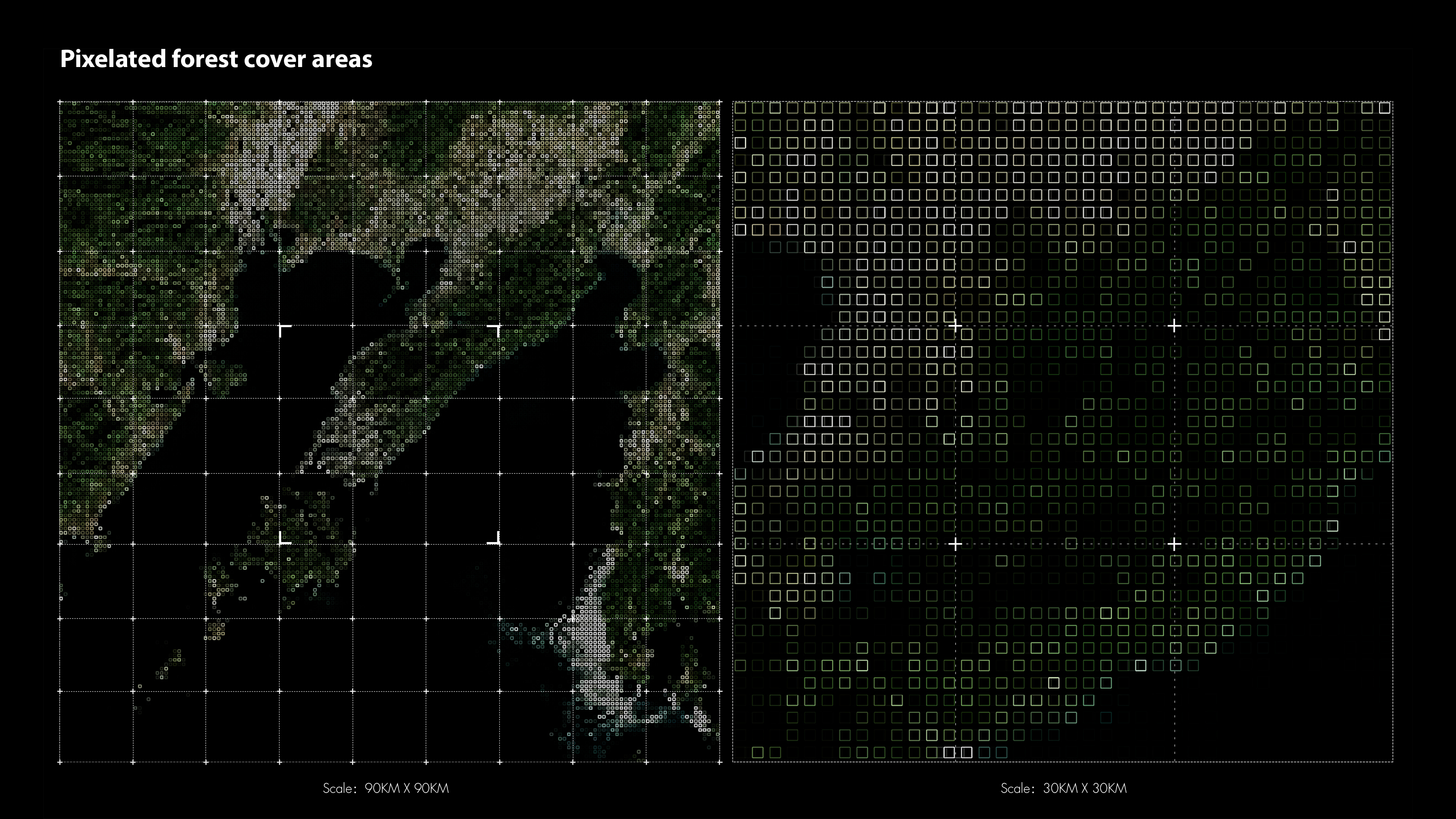
- Step 3, corresponding data to generate dot-matrix layers.
- Step 4, corresponding layers generate point cloud model and developing and analyzing point cloud model further. Finally, 3d virtual model and AR presentation --- final effect of data visualization and a new currency issue.
The forest is made up of a large number of trees, it is like a vast network in which each tree individually generates a new value. Each individual is equal and decentralized to the forest, and this concept of decentralization could perhaps be a new strategy for forest resources, like Bit-coin, like block-chain. In addition, the currency of this 3d model has two values, a collector's value (artistic) and an informative value (contains new landscapes and new data). Finally, we envisage a situation in which the ecological situation of the area can be brought into line with the interests pursued by the people.
We then ran simulations of styleGAN Based on the previous site size comparisons, we also made two videos of a contrasting nature. The left one is the large size of 2000 m and the right one is the small size of 200 m. The 200 m video is much clearer, so we targeted the 200 m size range and ran the next video.
In this video we have changed the parameters and increased the base value of the base map, we have increased the number of base maps to 270, we have made a simulation of stylegan and we can see in the video the continuous transition between the forest, the fields, and the desert.
In the end, we selected the series of layers most closely related to the forest and arranged them to create a styleGAN video.
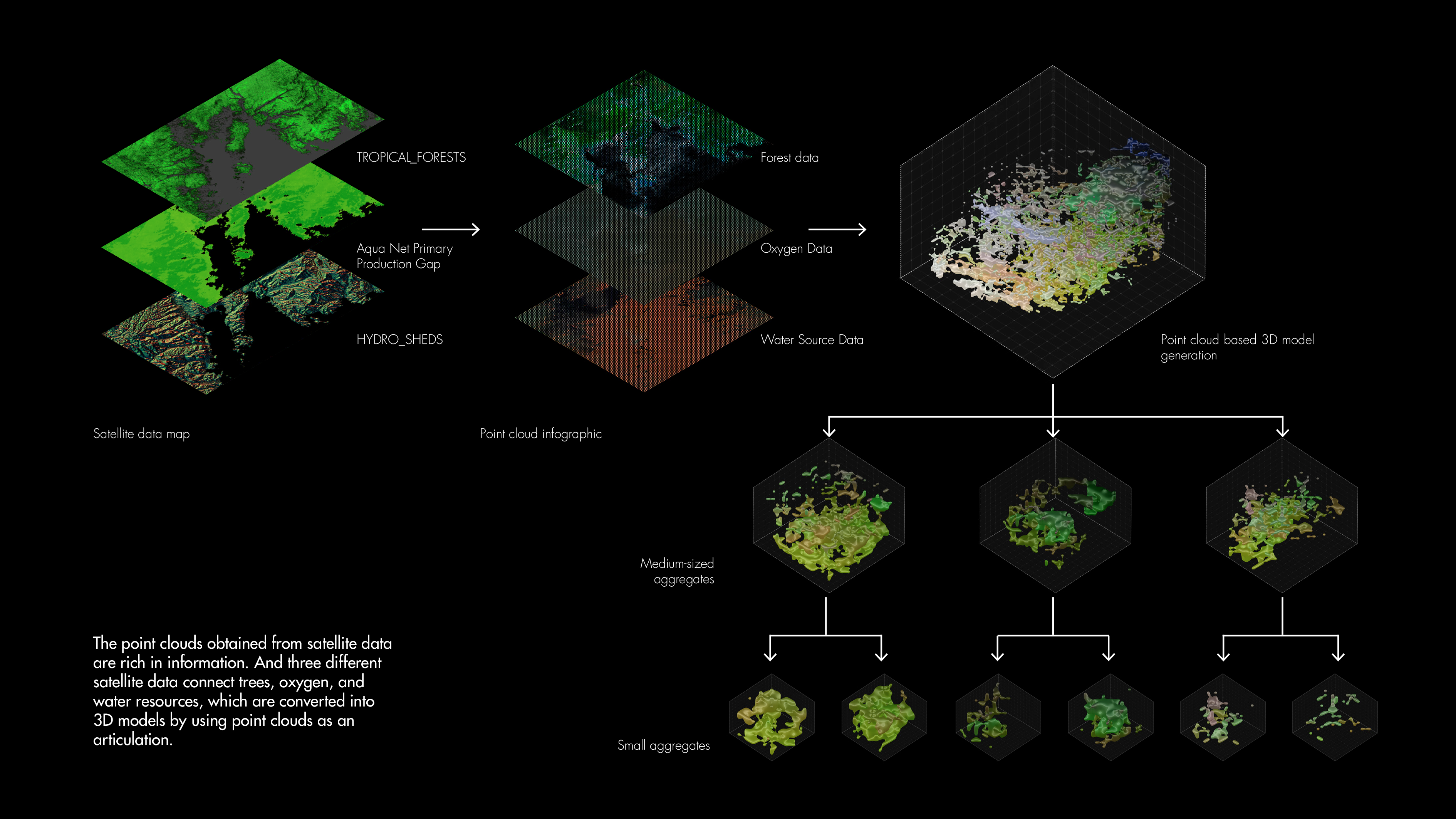
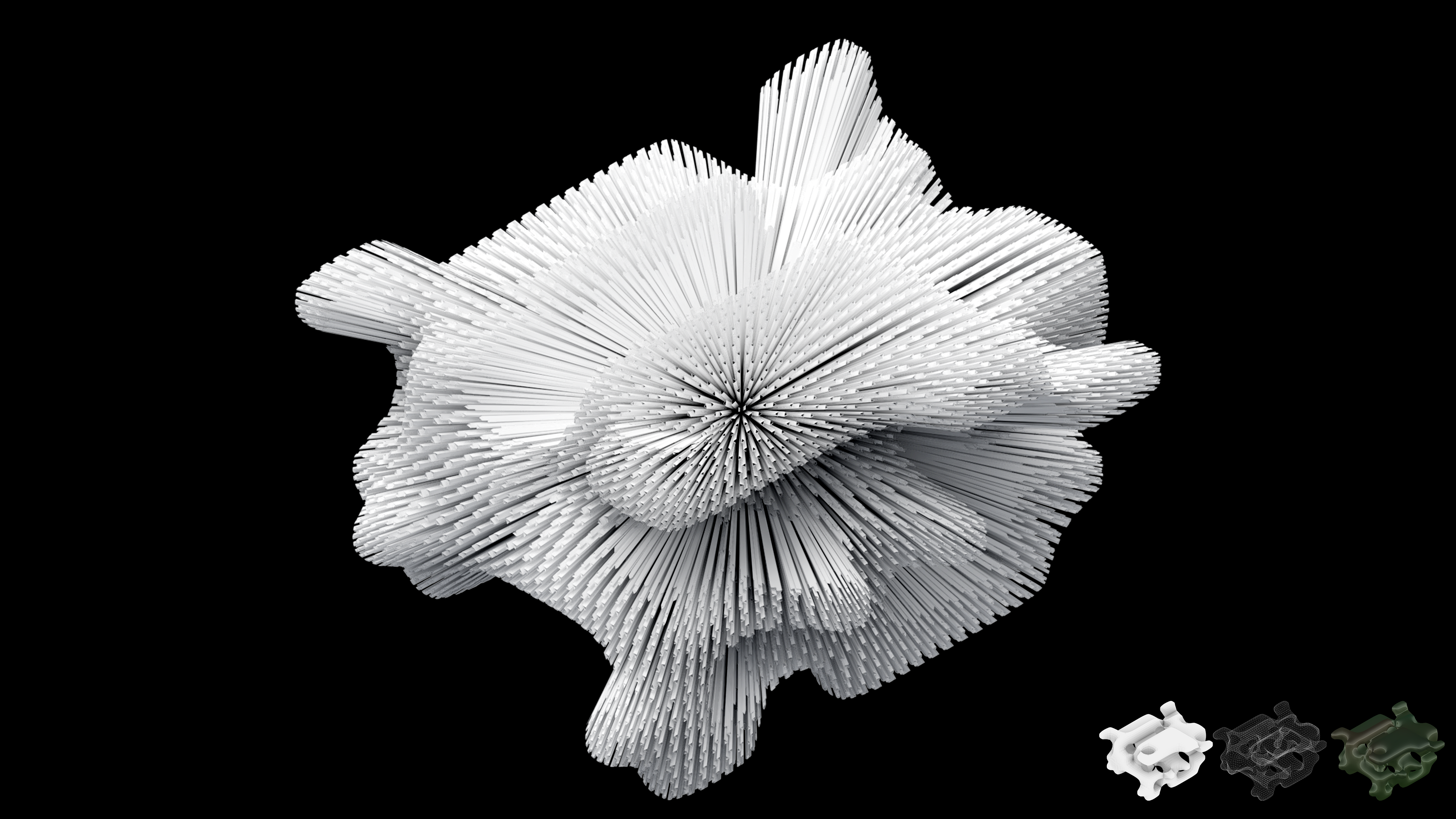
We then performed a point cloud generation of the selected images of the forest. The three of us each selected three images of the forest for the operation and came up with the following output.Finally, we performed the derivation of the model.
After extracting the point cloud, various fusion models and heteromorphic surfaces are generated to explore further developments in data visualisation.
This is the urban form generated by the point cloud and is a further processing of the data visualisation.
ER-COIN
RC16, G_04
Tutors:
Maria, Kuptsova,
Vadim Smakhtin,
Artem Konevskikh
Group Members:
Sheng Cao, SN:20081494
Shusheng Huang, SN:19129245
Meng Zheng, SN:20074441